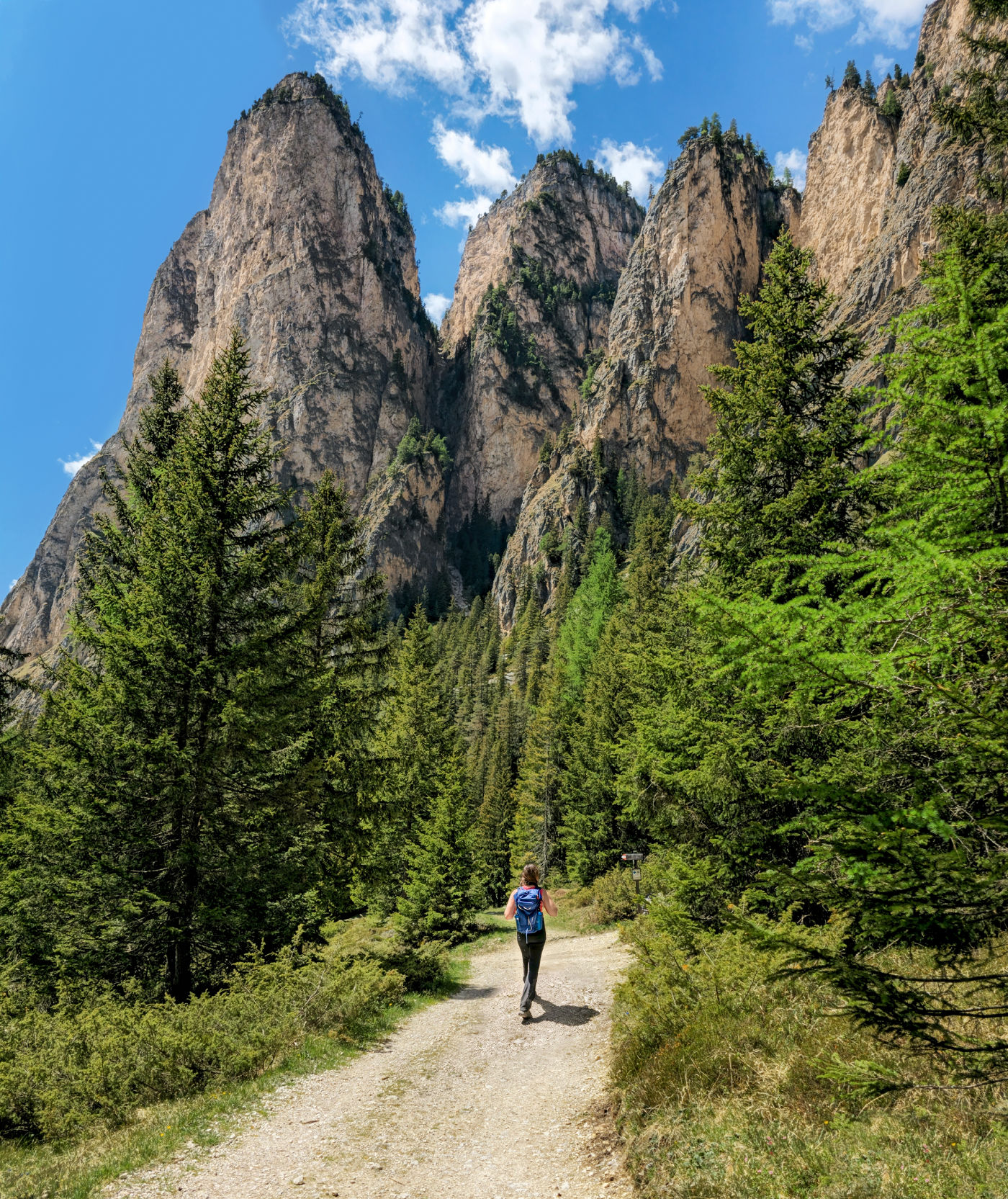
Stretching beyond Selva di Val Gardena, Vallunga — also known as Langental — follows the abandoned architecture of ancient ice into one of the Dolomites’ most peculiar valleys. The hiking is gentle; the surroundings are not, as green meadows give way to immense walls, fractured peaks and mountains shaped like something out of another world.
Some hikes are about reaching the top. Vallunga is about walking deeper into the mountains.
The trail pulls you through forest and meadow as the cliffs rise higher and the valley narrows around you, until the scale of the Dolomites starts to feel almost unreal… almost as if you have wandered into the ancient hall of some lost mountain kingdom, a realm mortals were never meant to roam.
No summit required to experience pure awe.
We will admit that before hiking Vallunga, we were prepared to be a little underwhelmed. Val Gardena has Seceda. Sassolungo. Resciesa. Alpe di Siusi just over the ridge. With that kind of competition, a mostly level walk along a valley floor sounded suspiciously like the hiking equivalent of taking the afternoon off.
It did not take Vallunga long to prove us wrong.
We hiked the valley beneath a clear late-spring sky, the meadows already deep green and the last snowmelt running down the mountain faces in thin silver threads. The trail was easy. Gravel and dirt. No grueling ascent. No exposed edge waiting ahead. Yet the farther we walked, the stranger and more imposing the landscape became.
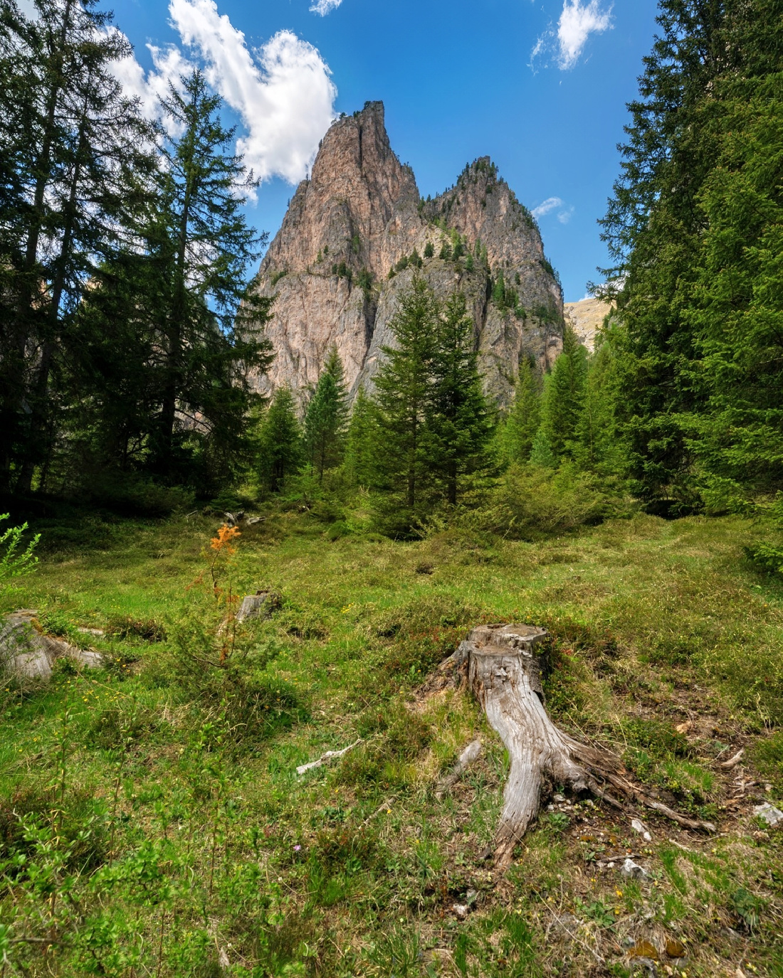
The mountains no longer resembled the familiar Dolomite towers we had been admiring all week. Some looked split by an axe. Others rose in great walls of broken teeth. And stranger still, some curved where the stone ought to have been sharp — as if the earth exhaled and the mountains captured its breath.
Somewhere along the way, we stopped feeling like hikers and started feeling like trespassers in another world. The trail may be gentle. The impression it leaves is anything but.
Vallunga / Langental at a Glance
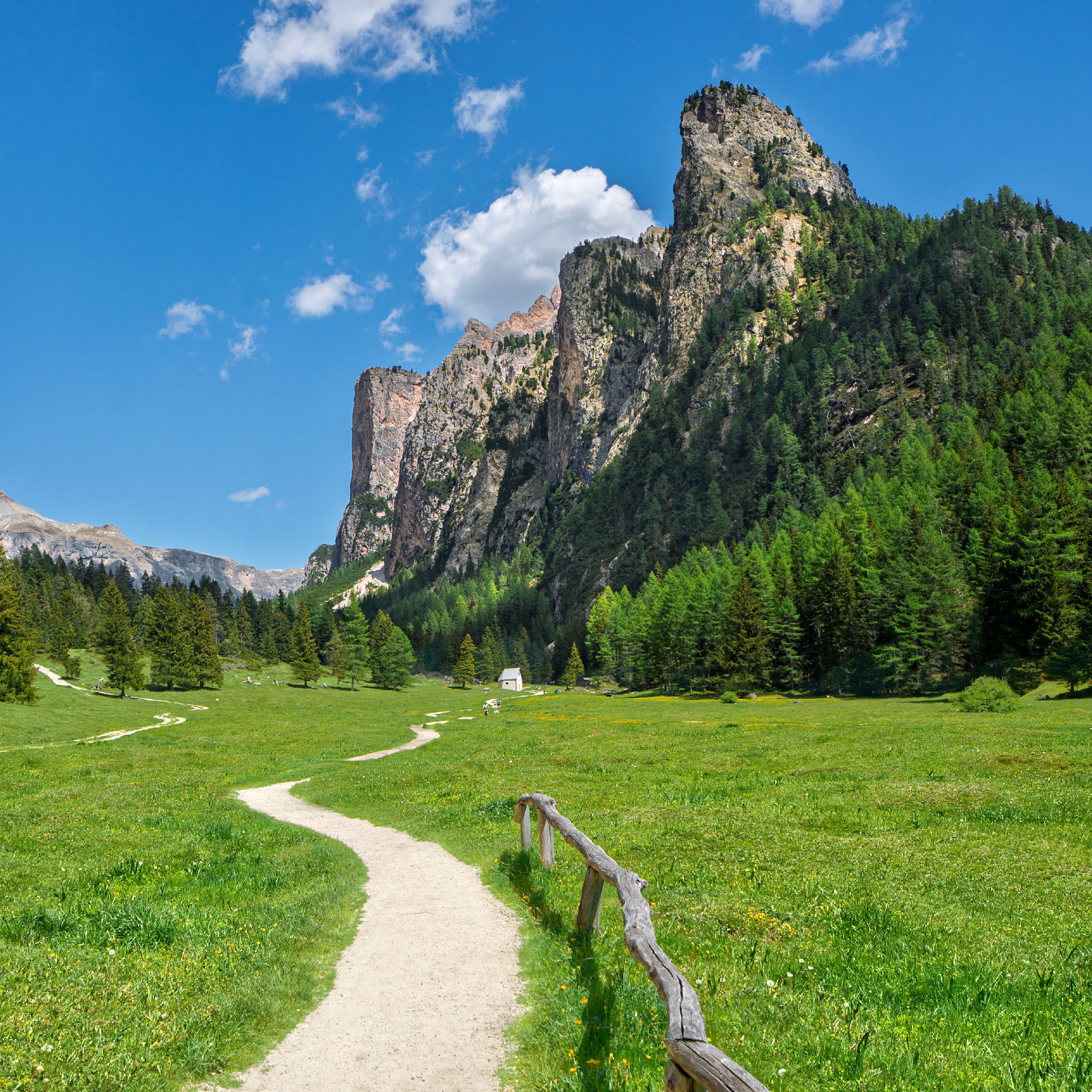
What is Vallunga: Vallunga is a long, glacier-carved valley stretching north from Selva di Val Gardena (Wolkenstein / Sëlva) into Puez-Odle Nature Park. Known as Langental in German and Val Longia in Ladin, it cuts deep into the Puez Group between the Stevia massif and the mountains of Chedul and Col Turond. Ice did the heavy lifting here thousands of years ago, scouring out the broad valley floor and leaving behind the immense rock walls that now rise around the trail.
What makes Vallunga unique: Vallunga delivers the scale and drama of the Dolomites without requiring a summit climb, exposed ridges or lift a ticket expense. The farther you walk, the more the valley closes around you, culminating at Prà da Rì, an enormous alpine meadow where green meadow, wildflowers and strangely shaped reddish mountains create one of the more peculiar landscapes we have encountered in Val Gardena.
How difficult is the Vallunga hike: The classic Vallunga out-and-back hike is easy. The route is primarily gravel and packed dirt with gradual elevation gain. It is an excellent choice for a first day in the Dolomites, a lower-key hiking day or anyone who wants dramatic mountain scenery without a strenuous climb. The straightforward terrain can also work well for children who are comfortable walking the distance.
How long is the Vallunga hike: The classic route is about 4.7 miles (7.5 km) round trip with approximately 659 feet (201 m) of elevation gain. Allow around two hours of actual walking, although we recommend allowing additional time at Prà da Rì. Here, the valley opens beneath the walls of the Puez Group. At around 5,900 feet (1,798 m), it makes a natural place to stop for a picnic, take in the scenery and turn back toward Selva.
Best time to hike Vallunga: Late spring through autumn works well, and Vallunga is also a top Dolomites winter hiking option. The valley is a dream for snowshoeing and cross-country skiing. We hiked it on a clear day in late spring when the meadows were intensely green, wildflowers were emerging and snowmelt was still spilling down several mountain faces.
What to Expect Hiking Vallunga
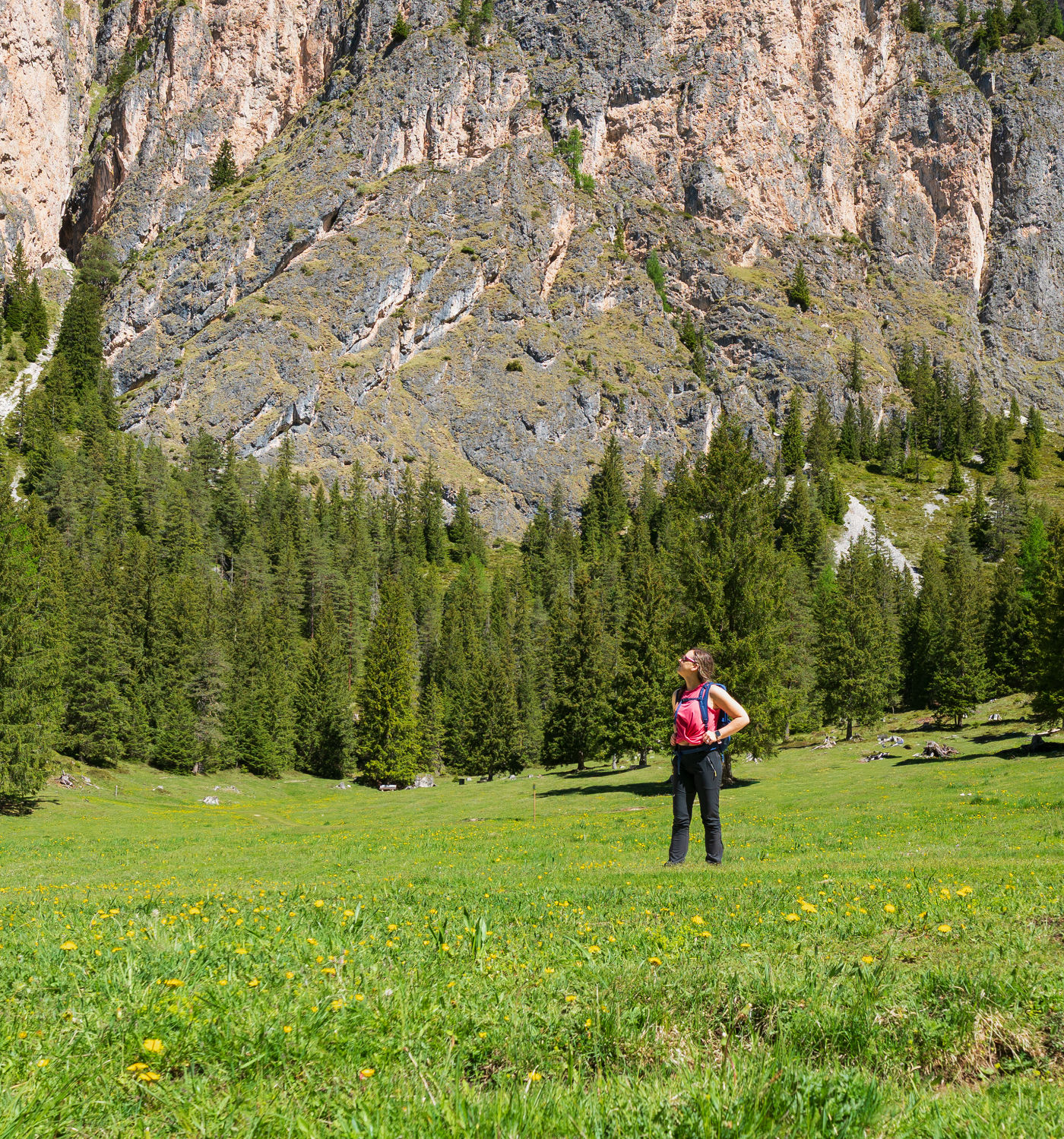
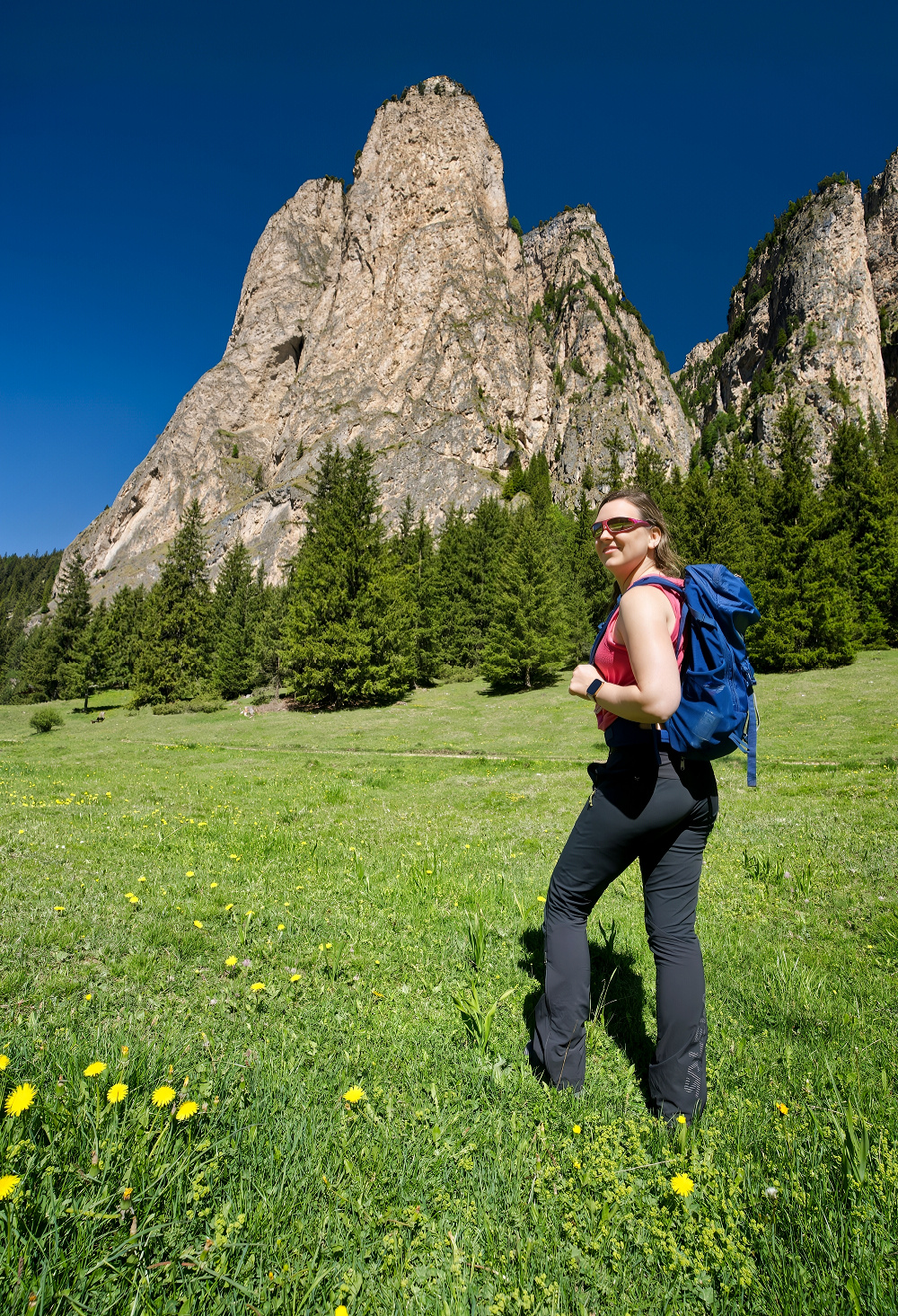
The hike begins on Trail No. 14 beneath Piz dai Schic, where the great Stevia walls rise abruptly to your left and form one side of Vallunga’s dramatic entrance. Opposite them, larch and pine forest sweeps up the slopes through Val de Chedul, a steep side valley climbing toward the jagged Cir peaks.
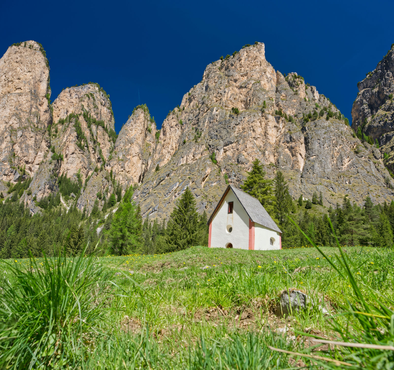
As you follow Trail No. 14 across the open meadow, St. Silvester Chapel soon appears ahead. It is a tiny white speck of civilization planted beneath an absurd amount of rock. Behind it rise Ciastel de Chedul, reaching 7,959 ft (2,426 m), and the sharper Piza de Chedul, at 6,483 ft (1,976 m), looming over the scene with the kind of scale that makes the chapel look almost comical.
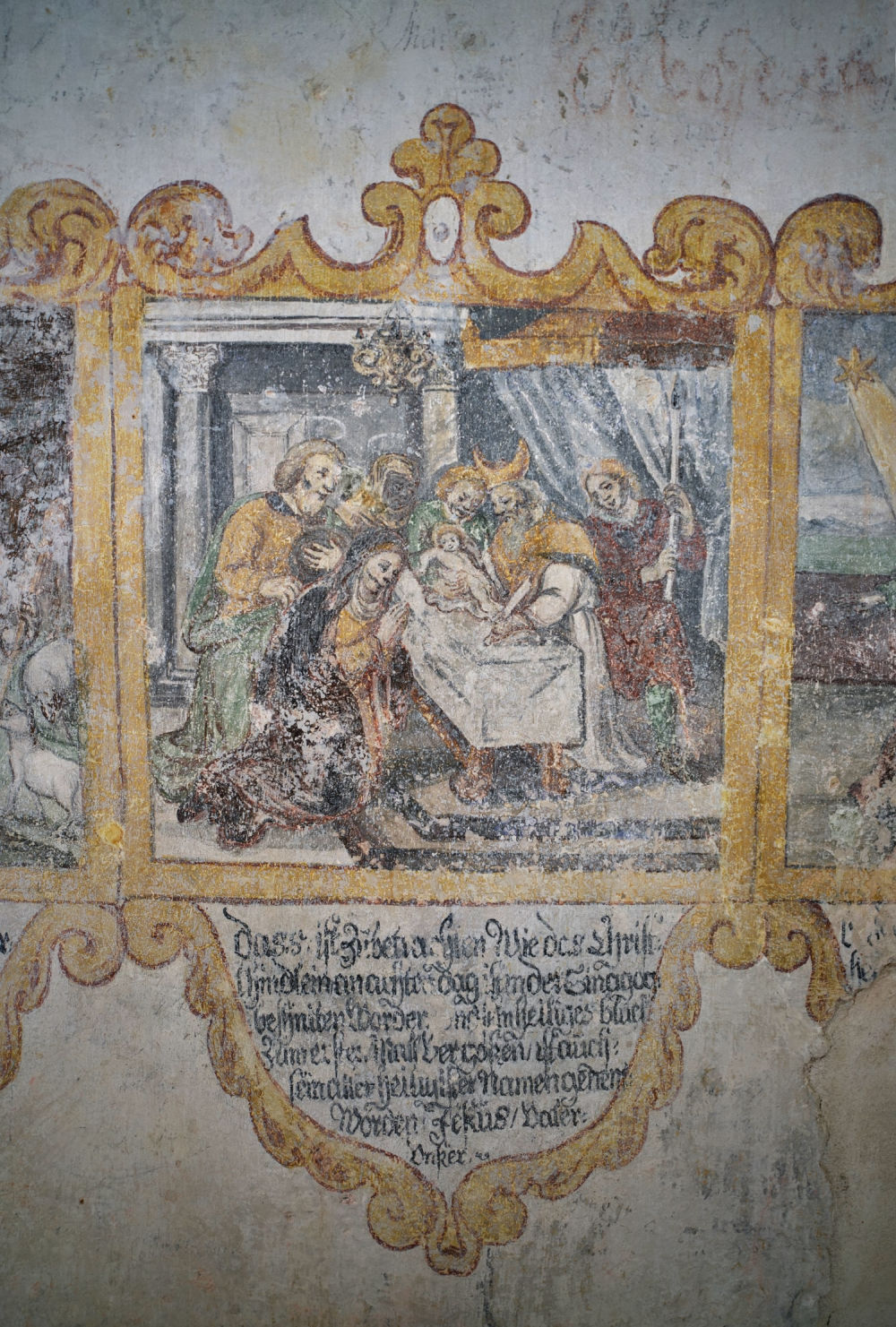
St. Silvester Chapel has stood in Vallunga as a place of silence and prayer for centuries. Dedicated to the patron saint of cattle, it’s exact age is unknown but frescoes inside point to at least the 1700s although it is thought to be much older.
Before continuing beyond the chapel, turn around. High in the Stevia wall behind you are the remains of Wolkenstein Castle, somehow wedged into a cleft in the rock. The castle was built in the early 13th century, came into the possession of the Wolkenstein family in the 14th, and collapsed in 1525. It was never rebuilt. The medieval poet and composer Oswald von Wolkenstein is said to have spent his summers there.
Welcome to the Hall of the Mountain King
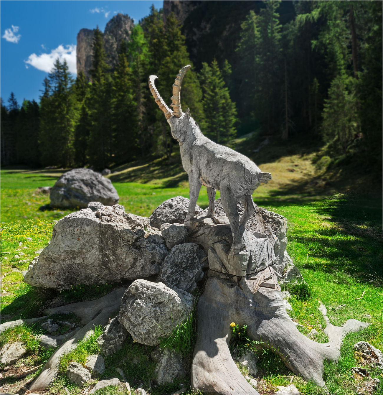
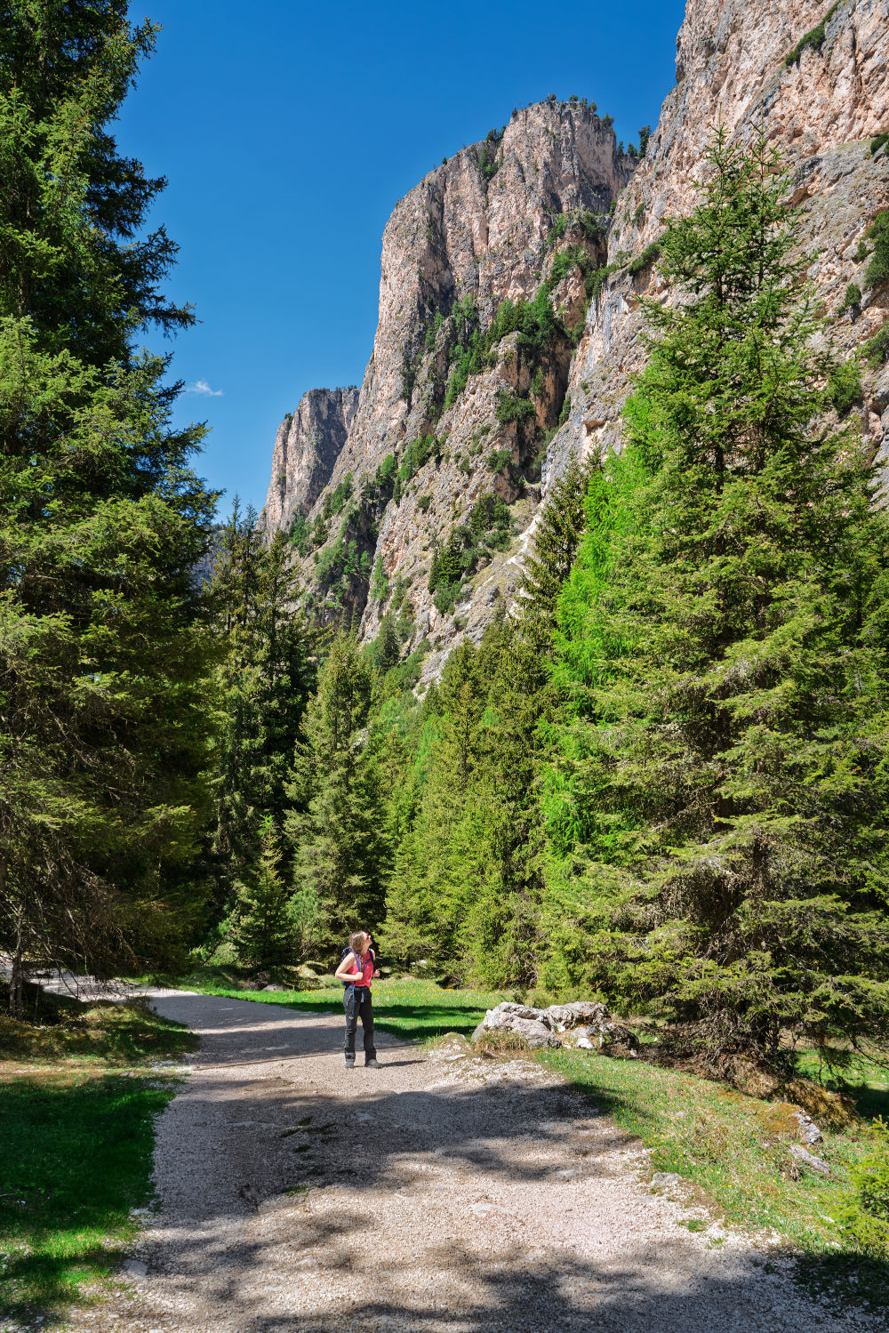
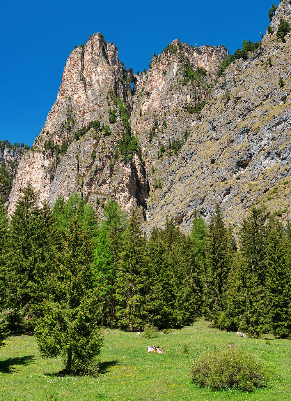
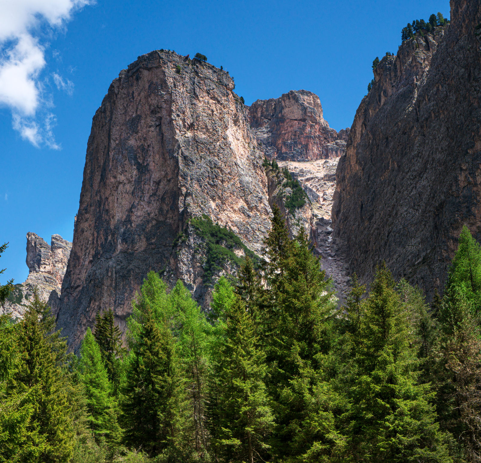
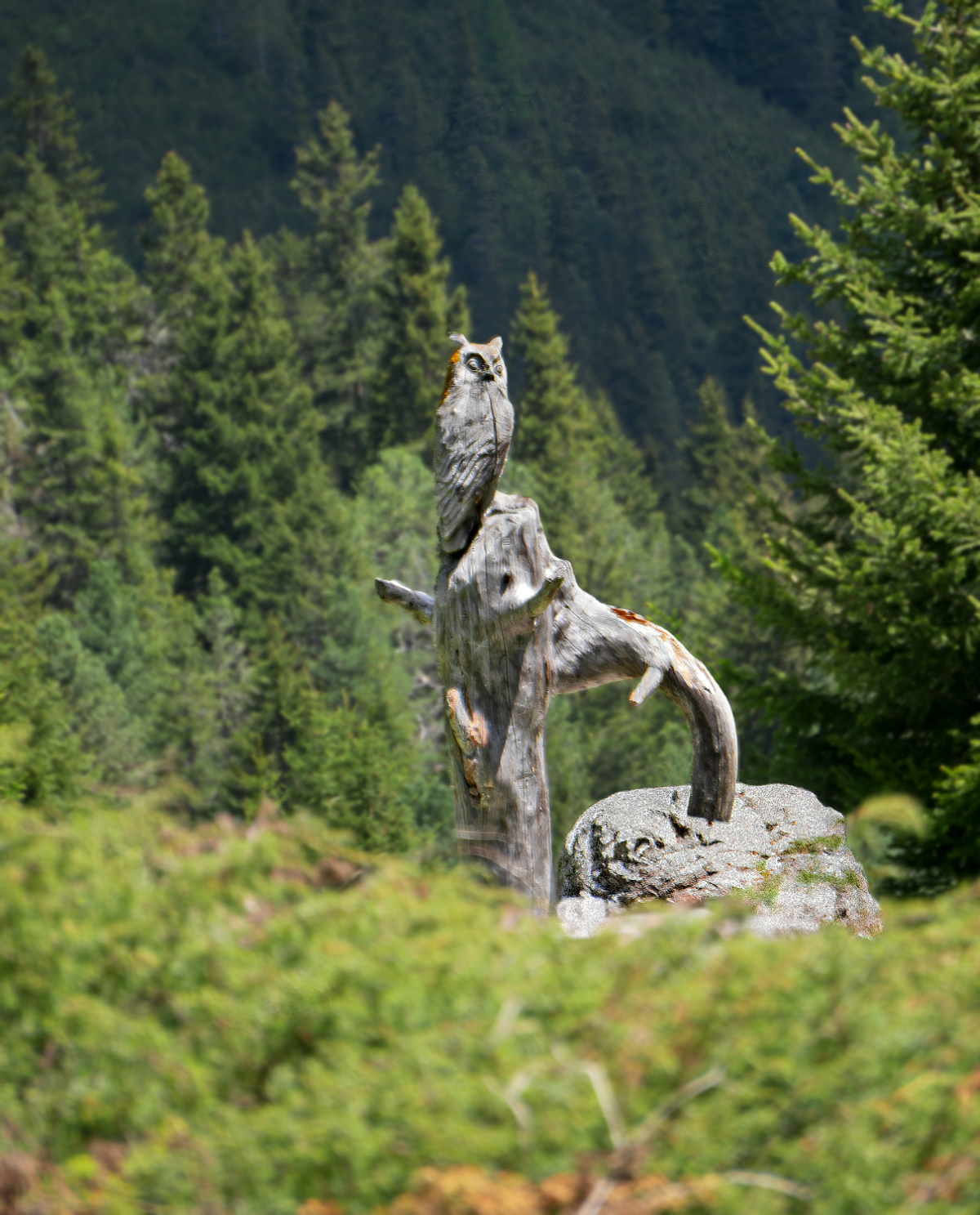
Shortly afterward, you will encounter a life-size ibex carved from wood along side the trail. Then Vallunga begins to change.
The trail itself trail remains much the same. But the mountains have other plans.
The walls rise higher, the valley narrows and before long Vallunga feels less like a hiking trail than a corridor blasted through the Dolomites. On your left, Ciastel de Stevia climbs to 7,310 feet (2,228 m), one of the first great slabs of rock to make the whole place feel increasingly improbable.
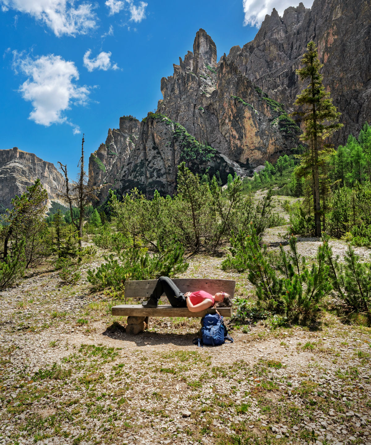
For roughly 1.5 miles, the corridor holds. Then Vallunga suddenly lets go and spills you into Prà da Rì, a yawning alpine meadow that serves as the natural turnaround for the classic hike.

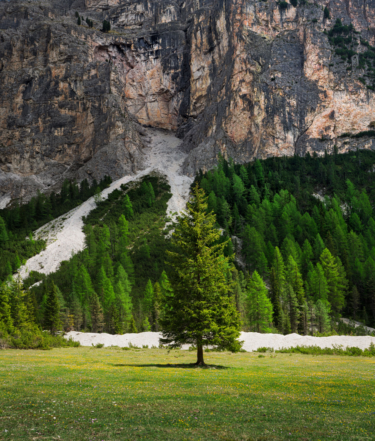

A wayside cross with a bench invites you take a seat. Enormous boulders lie scattered across the green expanse. And above it all towers Col Turond (8,711 ft / 2,655 m), looking less like a mountain than a fortress someone forgot to finish.
Then you notice the summit. Rising from the rock is a formation that looks suspiciously like a giant throne.
Of course it does. Every valley needs a king.
📌 Good to Know: If you have seen photographs of Lech de Ciampedel, the temporary lake that sometimes forms in Vallunga during the spring snowmelt, do not assume it will be there when you visit. Its appearance depends entirely on conditions from year to year, and we did not see it during our hike. If you are lucky enough to catch it, keep expectations in check: this is no Lago di Braies. Lech de Ciampedel is more ephemeral pond than alpine lake. If shimmering mountain water is what brought you to the region, there are far more impressive Dolomites lakes to seek out.
Vallunga’s Final Surprise
The hike back to the trailhead follows the same path toward Selva, but Vallunga does not feel quite the same in reverse. Sure, they are the same mountains, only seen from the opposite direction. That should not be particularly surprising. What surprised us was how many formations we had barely noticed on the way in suddenly demanded attention on the way out.
And just when we thought Vallunga had finished surprising us, we nearly stepped on a viper stretched across a sunny section of trail. That gets your attention quickly.
The snake was basking almost perfectly camouflaged against the ground before slipping into the grass ahead of our boots. It was a useful reminder that the Dolomites are not simply an attraction. They are an ecosystem.
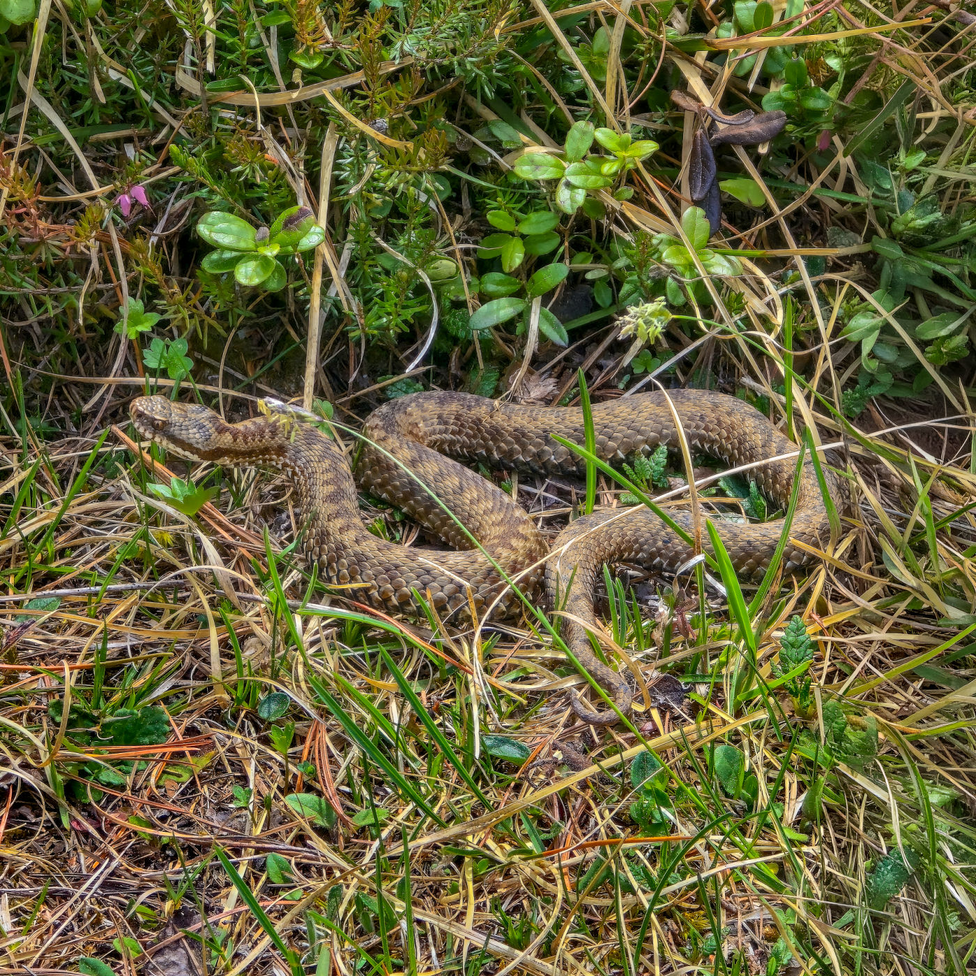
Meet Vipera berus, or more commonly known as the European adder. We nearly stepped on this beauty in Vallunga.
Marmots whistle from the rocks. Chamois move across the slopes. Cows occupy the trail whenever they damn well please. And occasionally, there is a venomous snake lying exactly where you planned to put your foot.
We gave it plenty of room and continued toward Selva, considerably more interested in where we were placing our feet than we had been five minutes earlier.
📌 Good to Know: On warm, sunny stretches, occasionally look down as well as up. Before sitting on a rock or stump, give it a quick glance. If you encounter a viper, do not touch or disturb it. No need to channel Steve Irwin. Give it space and let it move on.
Back near the trailhead, we finished the hike with a dessert at La Ciajota Hütte. A fitting return to civilization after spending a few hours somewhere that felt very far removed from it.
📌 Good to Know: Trail no. 14 does not end because the easy Vallunga hike does. It continues beyond Prà da Rì toward the Puez highlands and Rifugio Puez, but the character of the hike changes considerably. The official route is rated difficult and climbs to about 8,120 feet (2,475 m). If Puez is your goal, plan for it as a separate hike; for the classic Vallunga experience, turn around at Prà da Rì.
How to Get to the Vallunga / Langental Trailhead
One of Vallunga’s virtues appears before you take a single step. You do not need a lift to reach it. That means more beer money in our book.
The hike begins at the entrance to Vallunga on the northern edge of Selva di Val Gardena. If you are driving, a small paid parking area sits near La Ciajota at the mouth of the valley. Spaces are limited so you’ll want to consider arriving early during busier periods.
If you are staying in Selva, consider leaving the car behind altogether. Vallunga is close enough to reach on foot from the village, and local buses also serve the “Val” stop near the trailhead. From there, navigation becomes almost silly simple: follow trail no. 14 into Vallunga.
No gondola reservation. No timed entry. No need to spend breakfast checking whether a lift closes at 4:30 or 5:00. Just start walking.
📌 Good to Know: Vallunga is particularly useful hike during late spring and autumn when lift schedules elsewhere in South Tyrol and Val Gardena may be limited. It can also be a great poor weather option if visibility at higher elevations is limited.
Save & Pin for Later
Grab the free guide + follow for South Tyrol + Dolomites travel tips
25 Things to Know Before Visiting the Dolomites
Join 18,000+ travelers. No spam, ever.